Taking Pictures with Geo-Data (EXIF):
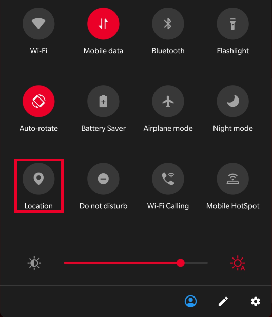
- Turn on the Location Services.
- Make sure that your camera application has permission to access your location, otherwise the pictures will not be able to be used for geotagging.
- Take a picture using your camera that now has permission to use location services.
- If you have not yet done so, be sure to create an account and log-in.
- You can click this link to go there directly: https://mappsnap.com/user/register
- After logging in go to this link on your phone or computer: https://mappsnap.com/node/add.
- This will take you to a page to create a post.
- Title the post with a name, preferably the name of the location or the street portion of the address.
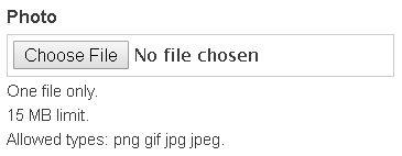
- Click on "Choose File" and upload a picture with EXIF data.
- On mobile you will also be given the option to take a picture and upload that instead of an already existing picture.
- Finally, scroll to the bottom of the page and click the "Save" button to save and publish your geotagged property.
- If you wish to preview your post before publishing it, you may click the "Preview" button to view how your post will appear once it is published.
GeoTag With a Picture:
Other ways to GeoTag:
- Fill out address and adjust map - Phone or Computer:
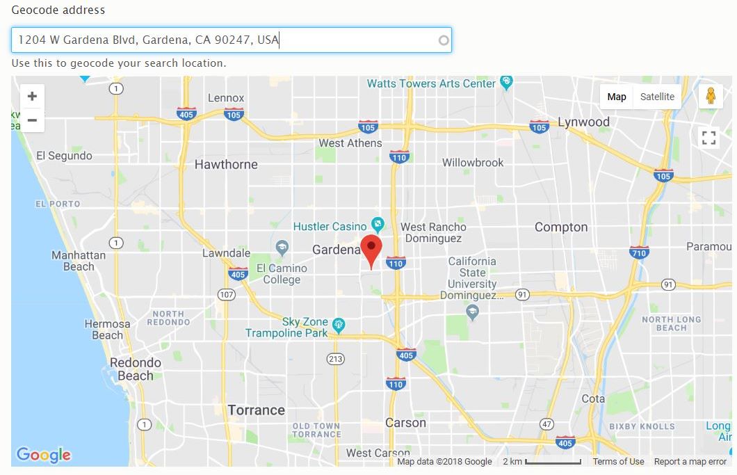
- If you do not have an image, do not wish to use an image, or are unable to geotag with an image it is still possible to geotag your property using the "Geocode address" part of the page
- Here simply fill out the textbar with your address and it will provide locations based on your address.
- Then, either click on a provided address or finish typing in your address and hit enter.
- You should see the map load the location and a marker for your address.
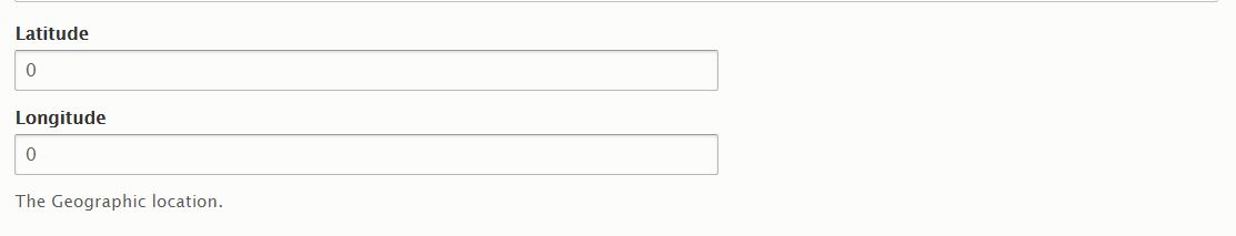
- Use Latitude and Longitude:
- Another method for geotagging is to use the longitude and latitude.
- Using Google Maps, Bing Maps, or another method of your preference find the longitude and latitude for your property.
- Then, enter the longitude and latitude into the textboxes.
- Please note that using this method may or may not change the map you see on the page until it is published.
Finalize your content
- When you have completed adding in the GeoData, please finalize the content by adding a title and any other necessary information about the property within the body.
- If you have any flyers or additional documents that pertain to the property please upload them accordingly within the files section of the content form.
- Once you have added the title and made sure that your property information is corrent, please click the save button at the bottom of the form to post your property.
- Please note that while not required, it is preferred that the title of your content be the full address of your property; if you choose to not use the full address of your property it may become difficult for other users to locate and view your property.